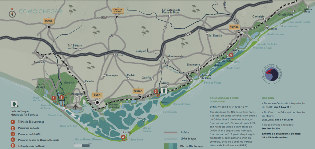
The Ria Formosa Natural Park (PNRF) extends along 60 km of the Algarve coast, from the Ancão Peninsula to Manta Rota and occupies around 18,400 ha, spread across the municipalities of Loulé, Faro, Olhão, Tavira and Vila Real de Santo António.
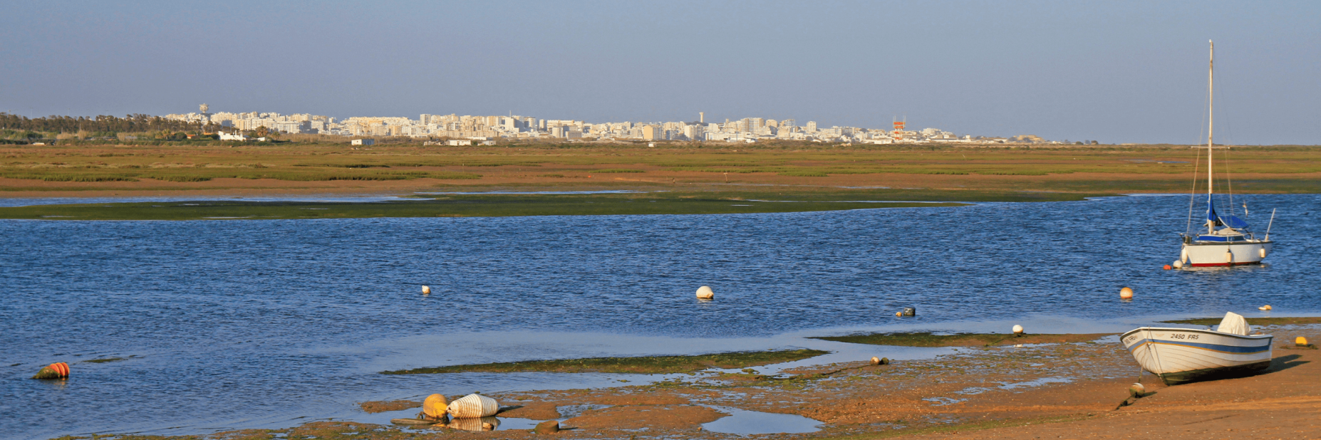
Most of this area (11,000 ha) corresponds to the Ria Formosa lagoon system, a string of islands and sandy peninsulas that extends more or less parallel to the coast, protecting a lagoon where a labyrinth of channels develops – uncovered at tide. low – salt marshes, mudflat areas, islets, salt marshes and freshwater inlet areas (mouths of the watercourses that flow into it, such as the Gilão River and the Almargem, Cacela and São Lourenço streams).
Part of the lagoon system is always submerged while another part emerges during low tide. The average depth of the lagoon is 2 meters.
The PNRF also has a continental land strip (7000 ha), made up mainly of urban settlements, pine forests and agricultural areas.
The entire area is part of a region with a Mediterranean climate, with light and irregular rainfall, mild temperatures and high sunshine.
Various peoples have sought out the Algarve coast or have settled here since the Paleolithic period – Conians, Romans, Visigoths and Arabs. This Man-Nature relationship, when balanced, can produce landscapes of great beauty combined with sustainable economic activities, as is the case of the village and promontory of Cacela Velha, the salt flats in the Ria Formosa salt marshes or the rainfed orchard on the continental strip.
However, when this fragile balance is broken, the wounds in the landscape are evident and the impacts on natural and cultural heritage are quite negative. This is what happened from the 1960s onwards with the growth of tourism in the Algarve, which took place in a disorderly manner, with the entire coastal strip being built and degraded inexorably.
The creation of the Ria Formosa Natural Reserve in 1978 (Dec. no. 45/78, of May 2) aimed precisely to protect the lagoon area from urban and tourist growth, given its great ecological, scientific, economic and social, as well as defending the surrounding good agricultural soils from other uses.
In 1987 it was reclassified as a Natural Park (DL no. 373/87, of December 9), as it was recognized that almost the entire area was subject to exploitation of its natural resources and was partially humanized, which does not fit the status. “nature reserve”.
The purposes of creating the Ria Formosa Natural Park were:
» The preservation and defence of the lagoon system;
» The protection of fauna and flora and their respective habitats;
» The orderly use of the territory and its natural resources in order to ensure their continuity;
» The promotion of economic activities compatible with the rational use of natural resources;
» The ordering and discipline of recreational activities, in order to avoid the degradation of the natural, semi-natural and landscape, aesthetic and cultural elements of the region.
More than 40 years after the national classification of the area, other international protection statuses were added, the most relevant being the Wetland of International Importance granted in 1981 by the Ramsar Convention and its integration into the European nature conservation network. , Natura 2000 Network, as a Special Protection Zone for wild birds (DL no. 384-B/99, of September 23) and Special Conservation Zone (DR no. 1/2020 of March 16), as a habitat natural flora and fauna.
Are you curious about this? So take a look at your map and next time you come to the Algarve, pay it a visit, and if you need accommodation, book one of our properties.
Source: visitalgarve.pt